Geological Brunton Compass About
Geological Brunton Compass Description
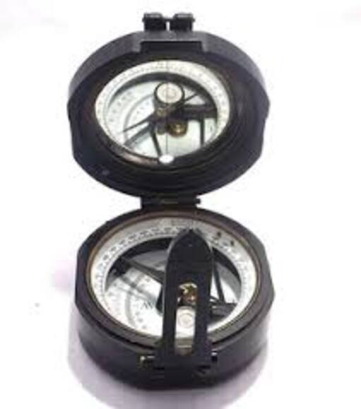
The Geological Brunton Compass is a precision field instrument used by geologists and surveyors for measuring directions, angles, and the orientation of rock structures. It is widely used for determining strike, dip, bearing, and slope during geological and topographical surveys.
This instrument combines the functions of a compass and clinometer, allowing accurate measurement of horizontal and vertical angles. It features a magnetic needle for direction finding, a sighting mechanism for precise alignment, and a graduated scale for angle measurement.
The Brunton compass is designed with a durable metal body for rugged field conditions. Its compact and portable design makes it suitable for outdoor geological exploration and long fieldwork use.
Features
- Measures strike, dip, and bearing
- Built-in clinometer for slope measurement
- Magnetic needle for accurate direction
- Strong and durable metal body
- Portable and field-friendly design
Applications
Used in geology, mining surveys, civil engineering, topographical mapping, and field research studies.
Precise Field MeasurementsWith a degree-graduated scale, integrated bubble level, and clinometer, this compass ensures accurate measurement of azimuth and dip angles during geological fieldwork. The magnetic sensor and polished or matt finish enhance readability and resilience in varied environments.
Designed for Rugged UseFeaturing robust aluminium alloy or brass construction and a protective leather pouch, the Geological Brunton Compass is engineered to withstand demanding outdoor conditions. It operates smoothly in temperatures from -20C to +50C and up to 90% relative humidity.
No Power Needed - Always ReadyThis purely manual compass requires no external power supply. Its analog display and precision mechanical components ensure reliability and longevity, making it an essential tool for geologists and earth science professionals working remotely.
FAQ's of Geological Brunton Compass:
Q: How does the Geological Brunton Compass assist in geological field surveys?
A: The Geological Brunton Compass helps measure azimuth and dip angles with high precision, enabling users to map geological structures, navigate accurately in the field, and conduct structural analyses necessary for effective geological surveying.
Q: What makes this Brunton compass suitable for harsh outdoor environments?
A: Its robust construction from aluminium alloy or brass, along with a leather carrying pouch, provides exceptional protection. The compass is designed to operate reliably within a temperature range of -20C to +50C and up to 90% non-condensing humidity, making it ideal for rugged field conditions.
Q: When should I use the clinometer function of this compass?
A: The clinometer function is used when you need to measure the angle of slope (dip) or the inclination of geological features like rock strata, bedding planes, or fault lines, which is critical in structural geology and mapping.
Q: Where can this compass be deployed for effective use?
A: It is best suited for field applications such as mapping, navigation, and structural measurements across varied geological terrains in India and similar regions, especially where reliable, manual instruments are preferred over digital options.
Q: What is the process for taking an accurate reading with the compass?
A: To obtain accurate readings, level the compass using the bubble level, align with the geological feature or mapping axis using the full-cover lid mirror, then read the degree scale for azimuth or use the clinometer for dip measurements. Ensure the compass is parallel to the measured surface for maximum accuracy.
Q: Can this compass be used for single or multiple measurements at a time?
A: The compass is designed for single measurements at a time, ensuring each reading-whether azimuth or dip-is taken with clarity and precision before moving to the next feature or location.
Q: What are the chief benefits of manual operation for this geological compass?
A: Manual operation eliminates dependence on batteries, ensuring continuous use during extended fieldwork. It also offers durability, straightforward analog readings, and resistance to electronic malfunctions common in remote or challenging environments.

 Send Inquiry



 Send Inquiry


 Send Inquiry