About Single station DGPS Differential GPS
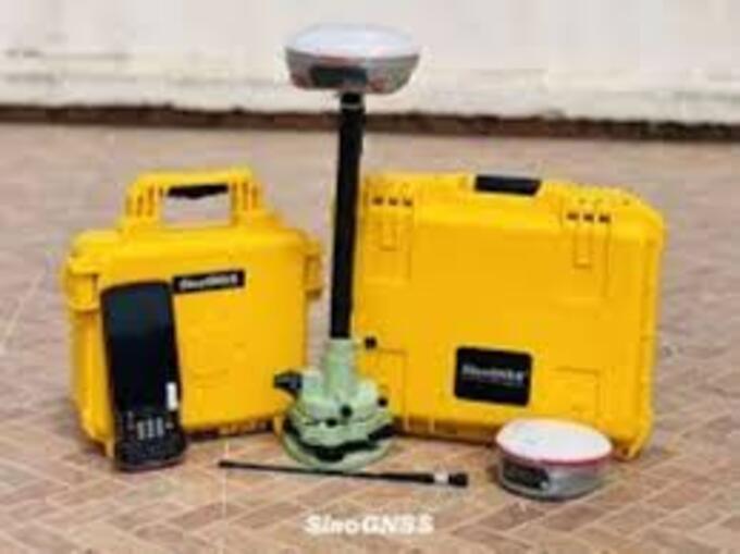
Single Station DGPS (Differential GPS) Surveying System
We provide a reliable and high-precision Single Station DGPS (Differential GPS) System, designed for accurate positioning and mapping applications. This system uses correction data from a single base station to enhance GPS accuracy, making it ideal for surveying, GIS, and construction projects.
The system works by placing a single base station at a known reference point, which continuously receives satellite signals and transmits correction data to the rover unit. These corrections significantly reduce positioning errors caused by atmospheric conditions, satellite clock errors, and signal delays.
Key Features
- Single base station DGPS configuration
- High positional accuracy up to 0.51 meter (DGPS mode)
- Supports GPS / GLONASS / BeiDou (model dependent)
- Real-time and post-processing capability
- Integrated communication (Radio / Bluetooth / GSM)
- Rugged, field-ready design (IP65/IP67)
- Long battery life for extended field use
- Easy installation and operation
-
Reliable Differential GPS for Precise PositioningEngineered for precision, this single station DGPS uses dual frequency bands (L1, L2) to provide consistent and accurate position correction data, essential for surveying, mapping, and navigation. Its advanced weatherproof housing and high resistance to humidity make it ideal for challenging outdoor deployments in India, ensuring uninterrupted operation in various conditions.
Flexible Integration and Data HandlingWith support for industry-standard data output formats such as NMEA 0183 and RTCM SC-104, integrating this DGPS system into existing workflows is straightforward. The device also features an internal memory capacity of up to 8GB, ensuring substantial on-board data storage for field operations without the need for immediate data offload.
FAQ's of Single station DGPS Differential GPS:
Q: How is the DGPS system installed for both temporary and permanent use?
A: The DGPS can be mounted on a tripod for temporary setups or installed permanently using fixed hardware. Its compact dimensions and weatherproof enclosure make it easy to deploy in any field or urban location.
Q: What are the benefits of using a DGPS with L1 and L2 frequency bands?
A: Using both L1 and L2 frequency bands helps minimize signal errors caused by atmospheric disturbances, delivering more precise and reliable positioning-ideal for critical surveying and navigation tasks.
Q: When should I utilize the selectable update rates between 1 Hz and 10 Hz?
A: Choose higher update rates (up to 10 Hz) for dynamic applications requiring real-time tracking (such as moving vehicles or vessels), and lower rates (1 Hz) for more static, periodic monitoring to conserve power.
Q: Where can this DGPS system be effectively used in India?
A: This weatherproof DGPS is suited for use in coastal, urban, and rural settings across India. Its 95% non-condensing humidity tolerance and rugged design allow reliable use in harsh weather or humid environments.
Q: What is the process for retrieving stored data from the device?
A: Data can be downloaded from the DGPS's internal 8GB memory via data ports compatible with NMEA 0183 or RTCM SC-104 formats, making it easy to interface with computers or data loggers for post-processing.
Q: How does the 8-hour battery backup enhance field operations?
A: The built-in battery allows the device to operate independently for up to 8 hours, ensuring continuous data collection during power outages or in remote locations without accessible mains power.
 Send Inquiry


 Send Inquiry